
 Credit: Carolina K. Smith/Adobe Stock
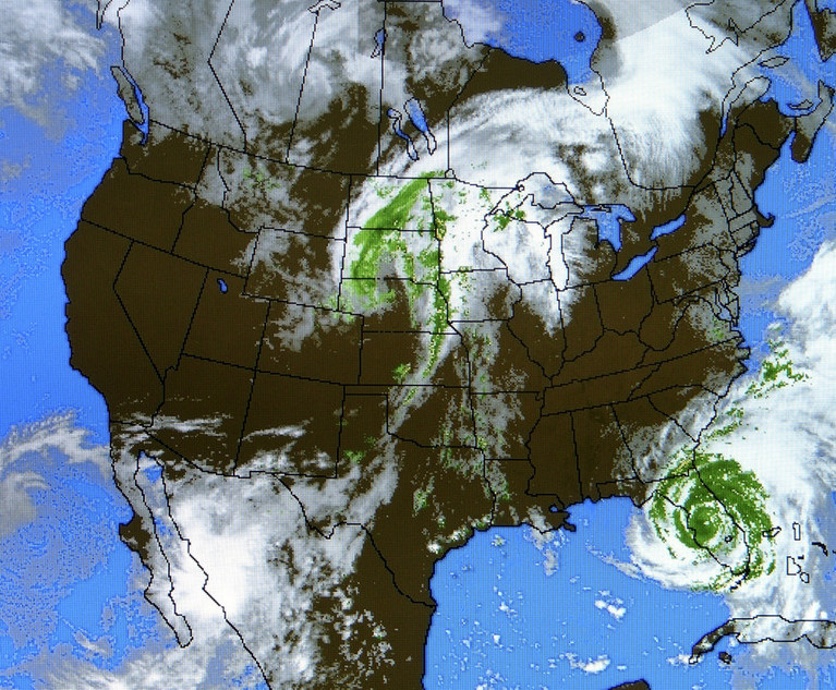
The National Oceanic and Atmospheric Administration (NOAA) recently released an update to its Disaster and Risk Mapping Tool that now allows users to assess natural disaster risks at the community level.
NOAA’S Disaster and Risk Mapping Tool Now Provides Granular Detail on Natural Disaster Risk
The Disaster and Risk Mapping Tool (the Disaster Risk Tool) now enables local governments, community members, and companies to visualize and analyze their exposure and vulnerability to extreme weather and climate events by census tracts, which are small county subdivisions of about 4,000 residents. With this granular detail, the Disaster Risk Tool identifies communities with socioeconomic vulnerability and a high risk from natural disasters.
This content has been archived. It is available through our partners, LexisNexis® and Bloomberg Law.
To view this content, please continue to their sites.
Not a Lexis Subscriber?
Subscribe Now
Not a Bloomberg Law Subscriber?
Subscribe Now
LexisNexis® and Bloomberg Law are third party online distributors of the broad collection of current and archived versions of ALM's legal news publications. LexisNexis® and Bloomberg Law customers are able to access and use ALM's content, including content from the National Law Journal, The American Lawyer, Legaltech News, The New York Law Journal, and Corporate Counsel, as well as other sources of legal information.
For questions call 1-877-256-2472 or contact us at [email protected]